The Dam
A dam was built at the eastern end of the shallow valley. The dam is 760 yards long and rises to a height of 51 feet at its highest point, which gives a depth of water of 38 feet.
The dam is constructed of Swithland slate with a centre core of puddled clay, obtained from land to the north side of the reservoir still known as "Puddledyke".
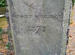
Puddledyke Clay Pit
Slate gatepost at village end of the dam
New Road
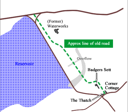
Sketch showing original line of redirected road
© 2017 Thurcaston & Cropston Local History Society
The road from Cropston to Hallgates was redirected over the new dam to make space for the new waterworks and filter beds.
The first section of the original road, from its junction on Station Road between The Thatch and Corner Cottage, still exists.